By Ingrid Petcu Levei | Museum of National History and Archeology, Constanta, Romania
Description
Enisala Fortress was built in the 13th century, was used by the Genoese in the 14th century, and Ottomans in the 15th century. During the 19th century, after a long period of abandonment, the fortress began to attract the attention of archaeologists and historians. Excavations and archaeological research were carried out in 1939 by G. Avachian and between 1970 and 1999, bringing to light many of the site's historical details.
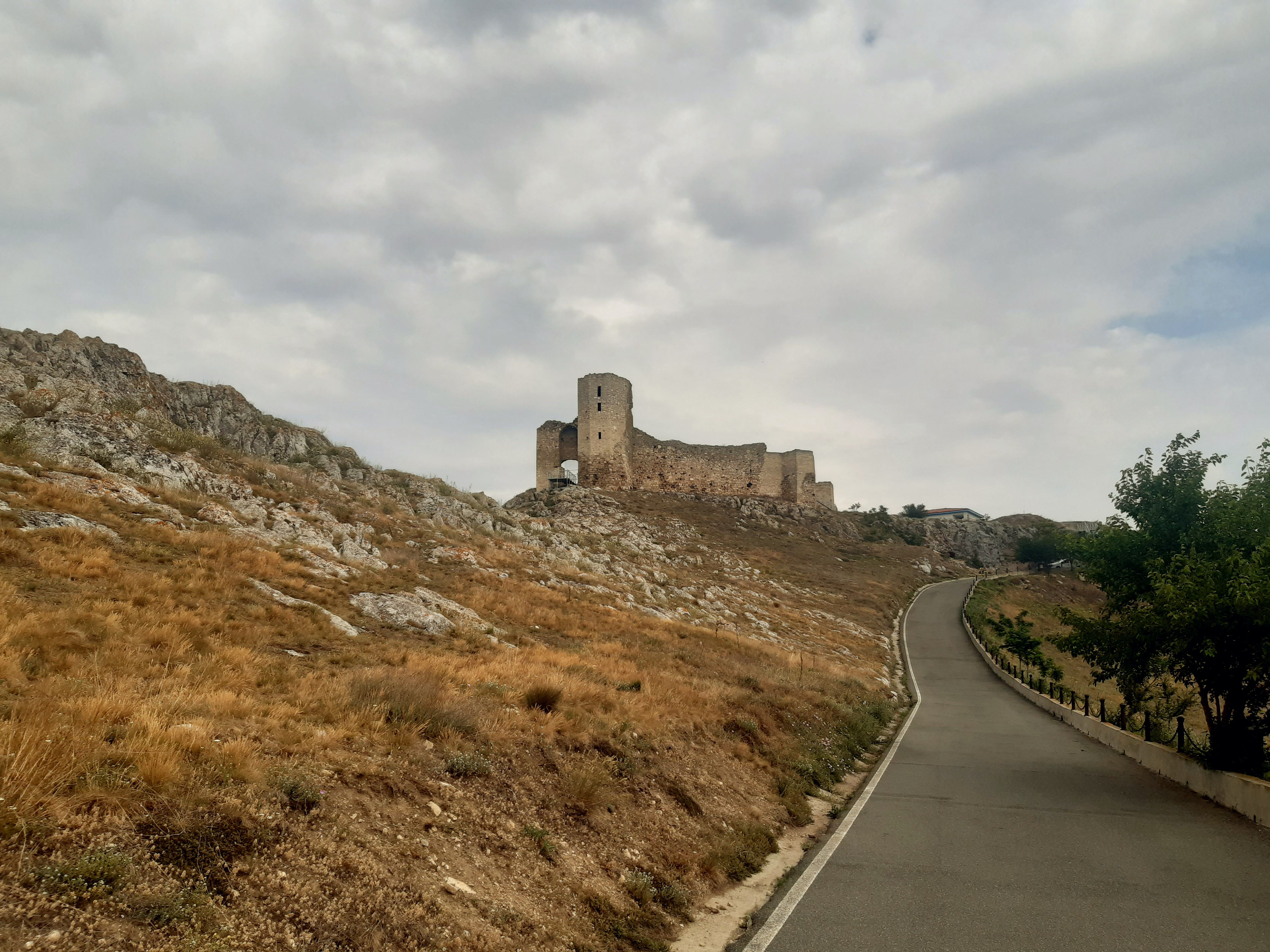
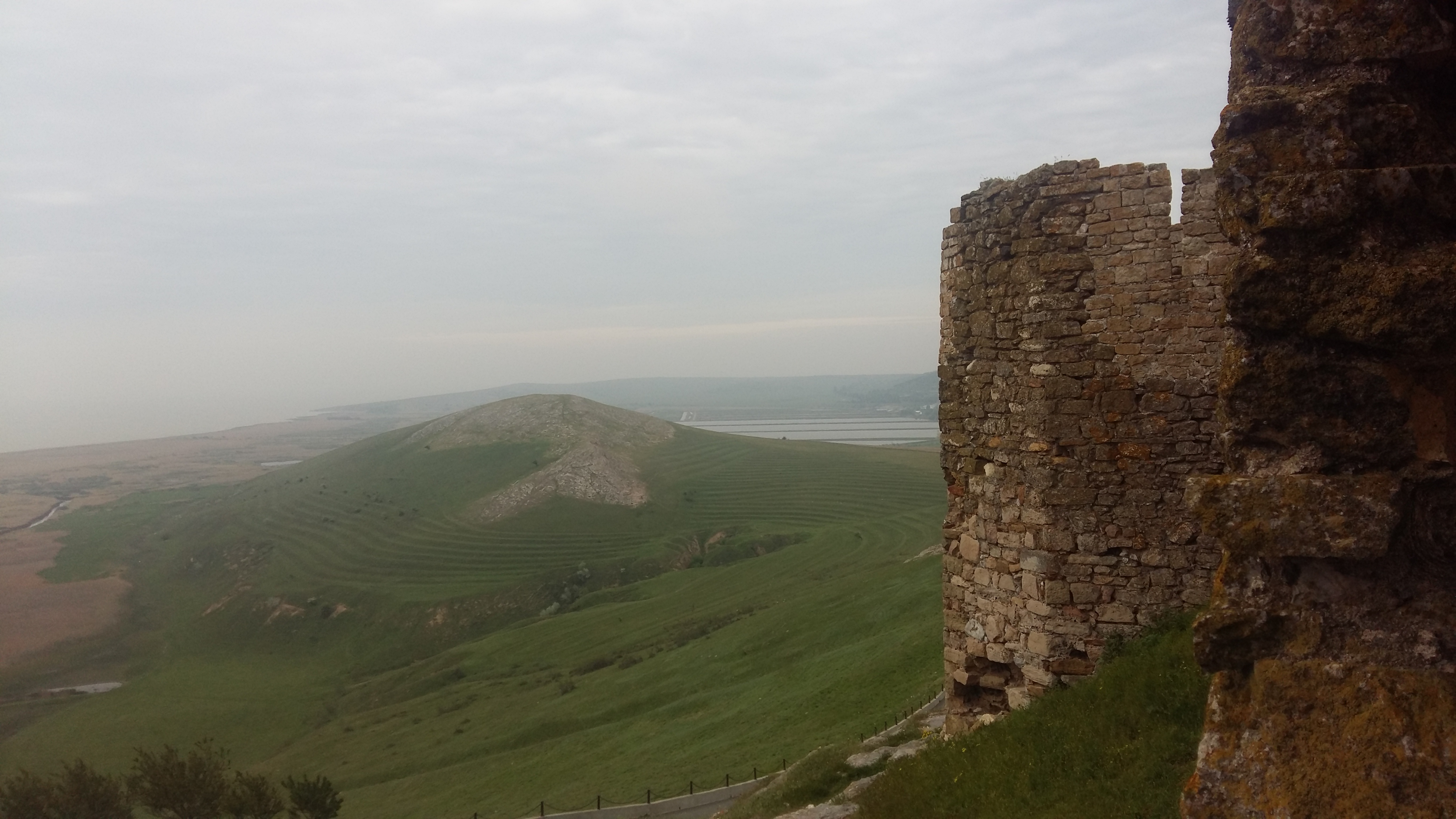
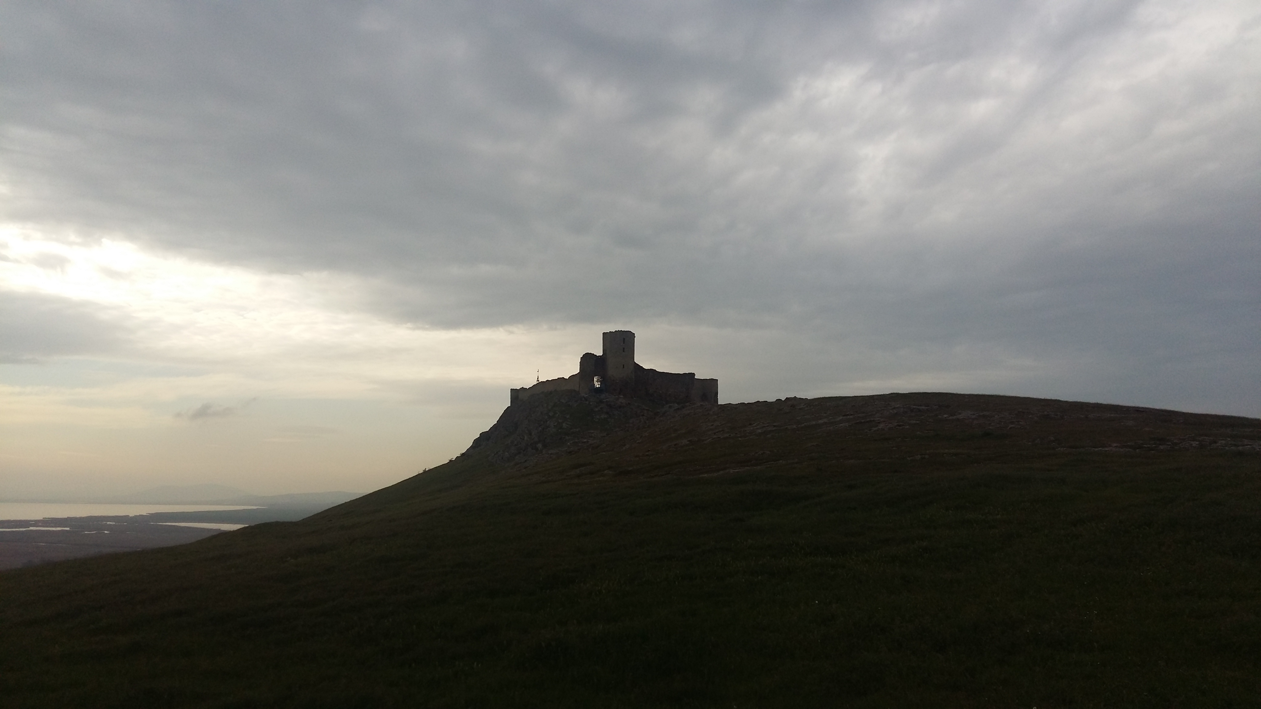
The fortress is strategically located on a rocky hill in Dobrogea, near Lake Razim, close to the Danube Delta and the Black Sea. This strategic position, at a height of about 100 meters above sea level, gave the fortress a defensive advantage, with good visibility. The fortress was originally built as an outpost to oversee trade routes. The position of the fortress is also remarkable for its proximity to the coastal plain and marshy areas of the Danube Delta, which added strategic importance for defense.
The Byzantine name for Enisala Fortress is Heracleea. This name was used in the Byzantine period and reflected the Greco-Roman influences in the Dobrogea region. Later, the fortress was known as Enisala, derived from the Turkish "Yeni Sale", meaning "New Settlement", after the area came under Ottoman control.
The first documentary mention of Enisala Fortress, which was then called Yeni-Sale, dates to the 15th century and it is found in the chronicle of Sükrüllah. In this text, it is meantioned as one of several of Genoese colonies that included the cities at the mouth of the Danube River. The novelty of this fortress was its military role; from there the Genoese were able to watch the commercial ships. A special element that individualizes this fortress, however, is that it survived the Russian-Turkish armed confrontations that took place on the territory of Dobrogea in 18th and 19th centuries. Two centuries ago, the generals of the Russian army ordered the destruction of all the medieval fortresses in the northern region of Dobrogea, where the garrisons of the Ottoman Empire operated. Only one escaped, because it was no longer active at that time. This is how Enisala remained standing and is now a major tourist attraction of northern Dobrogea.
Significance
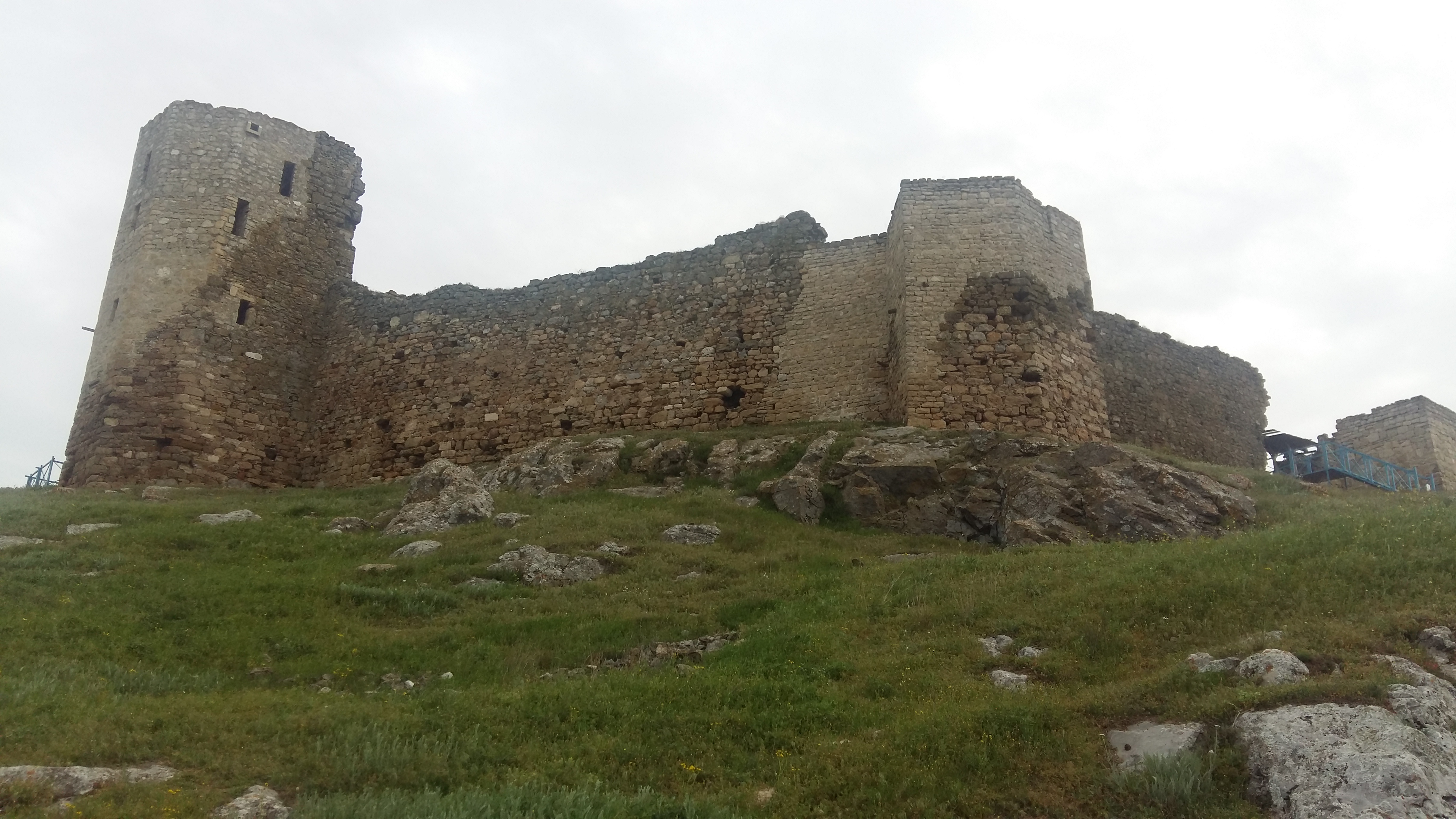
Enisala fortress has a complex history. The site has experienced several stages of occupation and use by various groups and regional powers. The plan of the fortress is an irregular polygon, somewhat following the geological shape of the massif on which it was built. The citadel was built from limestone blocks extracted from a nearby quarry, carved quite a bit, small and medium in size, approximately cubic in shape, arranged in relatively regular assizes. The enclosure walls, towers, and bastions of the fortress are partially preserved to a height of 5-10 m.
In the 14th century, the fortress was used by Genoese merchants who had a strong presence in the Black Sea basin. Enisala was an important control point for the trade routes between Constantinople and the northern ports of the Black Sea. During this period, the fortress was expanded and strengthened to protect Genoa's commercial interests. After the conquest of Dobrogea by the Ottoman Empire at the end of the 14th century, Enisala came under Ottoman control, being one of the few fortresses that remained intact after the occupation of the territories. During the 15th century, the fortress gradually lost its military and strategic importance. Once the Ottomans took full control of the region and established other fortified points, Enisala Fortress was gradually abandoned by the second half of the 15th century.
At the site, the discoveries from the medieval era are the most numerous, highlighting an intense habitation for this period. The earliest vestiges date to the period between the 8th and 9th century and consist of ovens and numerous ceramic fragments at the edge of the village. We can also add a series of interventions of a preventive nature in the central and southern area of the town, which indicate a habitation from the 11th century onward. The medieval rural settlement and the cemetery were active between the 13th and 15th century. From the point of view of medieval habitation, two phases can be observed: the first, prior to the construction of the fortification, dates to the turn of the 14th century; the second dates to the second half of the 14th century when the fortification walls were erected.
The main role of the fortification was a military and defensive one due to the strategic point where it was located. This gave the fortress a defensive advantage, with good visibility over trade routes and access to the Black Sea and the Danube Delta. Obviously, its purpose was to supervise the transit on water and on land. Based on the construction techniques, as well as the archaeological, material, and historical details, it was hypothesized that the only people interested in building a fortress located within the fortification system in the northern region of Dobrogea, facing the sea to control naval traffic, were the Genoese merchants, who had large sums of money earned from trade and who oversaw navigation on the Black Sea.
The material evidence discovered during the archaeological investigations - especially coins - attests to Byzantine, Genoese, Tatar, Moldavian, and Turkish presence at Enisala, and their involvement in the military, political, administrative, and economic role of the citadel. Recent excavations have also benefited from modern techniques, including geophysical methods and 3D scans, which have enabled a more detailed analysis of the site. The research projects have been carried out in collaboration with international universities and institutions, bringing together specialists from various fields such as archaeology, art history, and heritage conservation. The research results have been presented in specialized publications and conferences, contributing to a better understanding of the importance of Enisala Fortress in the historical and cultural context of the Dobrogea region.
Further Reading
Ailincăi, Sorin Cristian, Jugănaru Gabriel, Țârlea Alexandra, Mihail Florian, Vernescu Mirela, Ailincăi Adina. "Noi date referitoare la aşezarea culturii Babadag de la Enisala–Palanca, com. Sarichioi, jud. Tulcea. Cercetările arheologice din perioada 2003-2006." Revista Arheologică 7, no. 1-2 (2011): 157-199.
This article focuses on the archaeological investigations carried out between 2003 and 2006 in the Early Iron Age settlement from Enisala–Palanca, presenting the archaeological complexes, as well as an analysis of the finds. Chronologically, inhabitation can be assigned to the last phase of Babadag culture (8th - early 7th BC), before the founding of the Greek colonies on the western shore off the Black Sea. The current study is a good benchmark to understand all the chronological phases the area has gone through up to the current stage.
Baraschi, Silvia, and Gheorghe I. Cantacuzino. "Cercetările arheologice din cetatea de la Enisala (1976)." Peuce 8 (1980): 459-471.
This article discusses the building phases of the fortress, also detailing its architecture and the history of archaeological research at the site.
Iosipescu, Raluca, and Sergiu Iosipescu. "Cetatea Ienisala. Contribuții istorice și arheologice la proiectul de restaurare." Revista Monumentelor Istorice 78, no. 1-2 (2009): 109-124.
This article offers data about the history, architecture, and archaeological details of the fortress, which have served as the basis for the restoration of the fortress.